.

HIGH-PRECISION

AERIAL MAPPING

We turn complex data into strategic insights for safer, smarter decisions.

PRECISION

RESPONSIBILITY

SUSTAINABILITY

WHAT IS AERIAL MAPPING AND WHY DOES YOUR COMPANY NEED IT?

Aerial mapping uses drones equipped with high-precision sensors to capture data from terrain,
structures, and environments.

That data is processed through professional software,
generating 3D maps, orthophotos, digital elevation models,
and accurate measurements that replace slow, imprecise manual surveys.

SPEED &
PRODUCTIVITY

Surveys up to 10x faster

PRECISION
ACCURACY

Safer decisions with no rework

OPERATIONAL
SAFETY

Teams stay out of hazardous areas

ACCESS TO

REMOTE LOCATIONS

Reliable data in any
environment

OUR SERVICES

COMPLETE AERIAL MAPPING AND TECHNICAL INSPECTION SOLUTIONS

From aerial capture to final report, we deliver precise analysis to accelerate technical decisions and reduce operational costs.

OFFSHORE INSPECTIONS

Platforms, vessels, and critical structures

MAPPING &
SURVEYING

LiDAR, RTK, DTM, Contour Lines

ENVIRONMENTAL
MONITORING

Sampling, analysis, and safety

UAS/RPAS PILOT TRAINING (CLASS 3)

Professional training for safe and regulated drone operations

ANALYSIS & MEASUREMENTS

Orthophotos, volume calculations, drainage

AERIAL MEDIA PRODUCTION

Technical and corporate imagery

TECHNICAL INSPECTIONS

Visual and thermal (up to 400x zoom)

ODS DIFFERENTIALS

WHY LEADING COMPANIES TRUST ODS.

Ministry of Defense Certified

Authorized DJI Dealer

Certified RPA Pilots

Latest-Generation Equipment – LiDAR + RTK

Full Regulatory Compliance: ANAC, ANATEL & DECEA

Advanced Technical Data Processing

CUTTING-EDGE TECHNOLOGY, TECHNICAL ACCOUNTABILITY, AND SAFETY IN EVERY OPERATION.

DRONES & SENSORS

TECHNOLOGY THAT DELIVERS RESULTS

ODS-imagem-drone-e-sensores

We operate the DJI Matrice 350 RTK, equipped with the Zenmuse L2 (LiDAR) and H30T sensors, enabling 3D mapping, high-definition orthophotos, and precise thermal inspections.

All flights strictly comply with ANAC, ANATEL, DECEA, and Ministry of Defense regulations, conducted by certified RPA pilots.

SERVING KEY INDUSTRIES ACROSS BRAZIL

We operate across Brazil, bringing aerial technology where ground access falls short.

OFFSHORE

Oil platforms and marine structures.

CONSTRUCTION

Earthwork, grading, and physical progress monitoring

URBAN

Cities, residential developments, and urban planning.

AGRICULTURE
& FORESTRY

Agricultural surveys and environmental monitoring.

Technology and responsibility for a sustainable future.

In a world where precision and efficiency are essential, ODS Drone Solutions was founded in Macaé (RJ) — Brazil's Energy Capital — to deliver innovative solutions in aerial mapping, inspections, and high-precision 3D modeling.

Our mission is to set the standard in innovation, responsibility, and sustainability, transforming complex data into strategic insights that drive safe and informed decisions.

With a specialized team and state-of-the-art technology, we operate with integrity, transparency, and environmental commitment, continuously investing in training, data security, and sustainable practices.

OUR FOUNDER & CEO

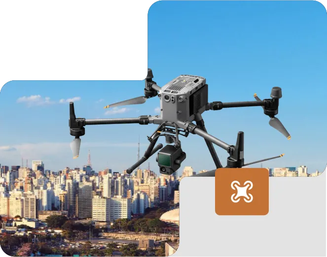
Daniel brings over two decades of experience combining strategic vision, technology development, and leadership in aerial operations. As CEO of ODS Drone Solutions, he leads a company specialized in cartography, surveying, and geodesy, delivering high-precision solutions for infrastructure and territorial management.

Currently pursuing a degree in Civil Engineering, Daniel combines a solid technical foundation with advanced expertise in LiDAR aerial mapping, large-format drone operations, and data processing on professional platforms such as DJI Terra. He holds Remote Pilot certification and is certified in offshore aerial inspection, demonstrating his ability to operate in critical environments and complex projects.

Driven by a career built on excellence and innovation, Daniel positions ODS as a national benchmark in high-precision geospatial solutions, blending responsibility, technical precision, and a vision for the future.

Scroll to Top